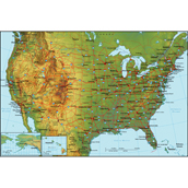
This lesson plan will help you introduce US Geography to your students.
Objective:
- Ss will be able to identify states of US
- Ss will match states and capitals
- Ss will describe different regions of US
- Ss will distinguish between north, south, east, west, right left, above, and/or below
Time: 50 Minutes
Material requirements: Blank map of the United States
Warm up:
- Ask Ss how many states America has
- Ask Ss how many capitals
- Why are there 50 states and 51 capitals?
- Ask Ss how many states are on the contiguous US
- Which two are not connected
- Can Ss name any states with their capitals
Presentation
- Present Ss with blank map and begin with Washington
- Have Ss label it with capital
- Ask Ss what state is south of Washington or under Washington
- Ask Ss what state is south of Oregon or under Californian
- Ask Ss what state is south or under Oregon and east or right of California
- Repeat this until all states are labeled
Practice
- Have Ss draw borders separating states by regions
- West
- Mountain West
- South West
- etc
- Explain why each region is named so
- The West because of its location as the furthest west part of US
- The Great Plains due to their vast expanse of plains
Application
- Ss asked why they had to know such worthless information
- I explained that I wanted them to have a vague idea of the US and its geography so they would know where exactly Eminem was from when they talked about Detroit, Michigan


